Chapter B17: Conflicting Land Use Buffers
1 - Introduction
1.1 Scope of this Chapter
This Chapter applies to sites located within the nominated buffer distance from the nominated sites listed in the following table. Map depicting the following sites and buffer areas are provided in the Appendices of this Chapter.
Table B17-1: Nominated Sites with Conflicting Land Use Buffers
| Subject Site |
Property Description |
Average Buffer Width |
| Frederickton Abattoirs |
Lot 1713 DP717943
Parish Yarrabandinni
151 Great North Road
Frederickton |
As per plan |
| Kempsey Timbers Sawmill |
Lot 1 DP878995
Parish Yarravel
116 Armidale Road
Greenhill |
As per plan |
| North Street Sewerage Treatment Works |
Lots 5/6 Sec 29A DP758556
Parish Yarravel
North Street
West Kempsey |
400m |
| Stock and Saleyards & Tick Dip Site 1 |
Lot 1 DP530690
Parish Yarravel
42 Saleyards Road
West Kempsey |
200m |
| Central Garbage Depot |
Lot 7008 DP96356
Parish Beranghi
638 Crescent Head Road
South Kempsey |
750m |
| Churchill Quarry |
Lots 186, 187 & 189 DP754400
Lot 1 DP914805
Lots 14 & 16 DP1157615
Parish Beranghi
Crescent Head Road
South Kempsey |
250m |
| Tick Dip Site 2 |
Lot 18 DP749161
Parish Yarravel
42 Turners Flat Road
Skillion Flat |
200m |
| Tick Dip Site 3 |
Lot 29 DP752419
Parish Kullatine
57 Maineys Road
Turners Flat |
200m |
| Tick Dip Site 4 |
Lot 119 DP752406
Parish Burragong
Fischers Road
Corangula |
200m |
Not all offensive or hazardous sites in the Kempsey Shire local government area are mapped. Consequently, this chapter will also apply to any situation where there may be conflict between residences and land uses that are likely to have a negative impact on residences through the emission of noise, odour, dust and other nuisance or pollution conflicts.
1.2 Relationship to Other Chapters of this DCP
The provisions contained in this Chapter override the provisions of any other Chapter of this DCP, to the extent of any inconsistency.
1.3 Definitions
Protected land use is any land use that is likely to have a negative impact on residences through the emission of noise, odour, dust and other nuisance or pollution conflicts. Examples of these types of uses are abattoirs, large sawmills, quarries, stock dip sites and sewerage treatment works.
Nominated Buffers are those buffers identified in the Appendix of this chapter.
2 - Chapter Objectives
The objectives of this Chapter are:
- To minimize the potential for conflict between residences and existing protected land uses.
- To protect the level of operation of existing protected land uses from inappropriate development that would lead to the need to reduce the level of operation of such protected land uses.
3 - Development Requirements
3.1 Development within Nominated Buffers
Desired Outcomes
DO1 - Dwellings are not sited within nominated buffers unless:
- the dwelling is sited so as to minimise the potential impact of nuisance arising from the protected land use;
- the dwelling has no significant impact on the operation of the land use likely to produce noise, odour, dust, nuisance or pollution conflicts; and
- where required, appropriate measures to reduce any conflict are provided.
DO2 - Non-residential development within buffers is compatible with the operations of the protected land use.
DO3 - Any amendments to Kempsey Local Environmental Plan 2013 do not result in the ability to increase the residential density within nominated buffers.
DO4 - The removal of vegetation within buffer areas is minimized, in order to maximize visual screening of protected land uses.
Note - The use of minimum distances for the buffers means that nuisance emissions from a protected land use will likely occur outside of the buffer and persons residing outside of buffers should not expect nil nuisance from the protected land use.
Development Requirements
Nil.
3.2 Other Protected Land Uses not Specifically Nominated
Desired Outcomes
DO1 - The location and size of any buffers created for protected land uses are based on a reasonable assessment of the impacts of the protected land use on existing and potential residential development.
DO2 - New development within the vicinity of protected land uses, not specifically nominated in this chapter, do not have an adverse impact on the operations of the protected land use.
Development Requirements
- The location and size of buffers created for an existing protected land use, that encroaches on adjoining lands in different ownership, are to be designed based on consideration of the following matters:
- the previous long term use of the site and the potential long term continuation of the land use, development or activity;
- the likely nature of and potential for conflict if dwelling houses are permitted in close proximity to or within the sphere of influence of nuisance emissions from the subject site;
- the burden any such buffer would place on the ability to develop adjoining lands. Particularly their ability to accommodate a single dwelling house outside of the buffer;
- any history of complaints;
- the size, scale and nature of the activity;
- whether the existing land use, activity or development is of local, shire, regional or state significance and the impact its closure or cessation might have on employment opportunities and the economy of the Shire or locality;
- the identification of a reasonable buffer distance in terms of the particular nuisance being submitted, for example odour, fumes, noise, dust and so on;
- the extent to which the owners, operators and or managers have endeavoured to reduce emissions from the site and proposed measures to further improve the facility to reduce the impact of nuisance emissions.
Note 1 - The establishment of a buffer will not be accepted as a substitute for proper management, maintenance and continued efforts to minimize any nuisance resulting from the land-use, activity or development.
Note 2 - Section 79C of the Environmental Planning and Assessment Act 1979 requires consideration of the environmental impacts of development in the assessment of any development application. Environmental impacts include impacts associated with noise, dust, odour and pollutants generated from development.
Appendices
Appendix A - Map: Frederickton Abattoir, Great North Road, Frederickton
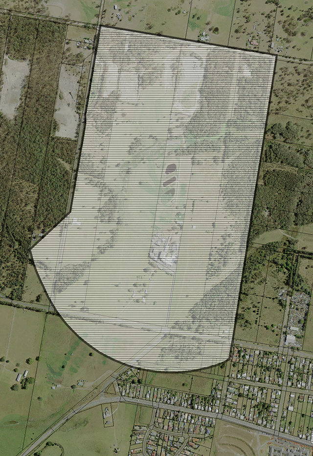
Figure B17-1: Map - Frederickton Abattoir
Appendix B - Map: Kempsey Timbers Sawmill, Armidale Road, Yarravel
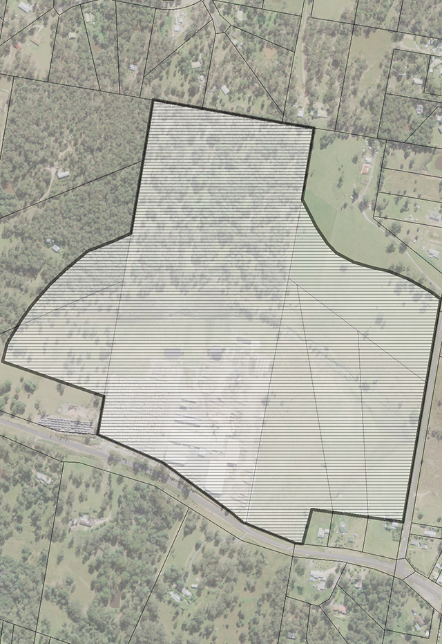
Figure B17-2: Map - Kempsey Timbers Sawmill
Appendix C - Map: North Street Sewerage Treatment Works
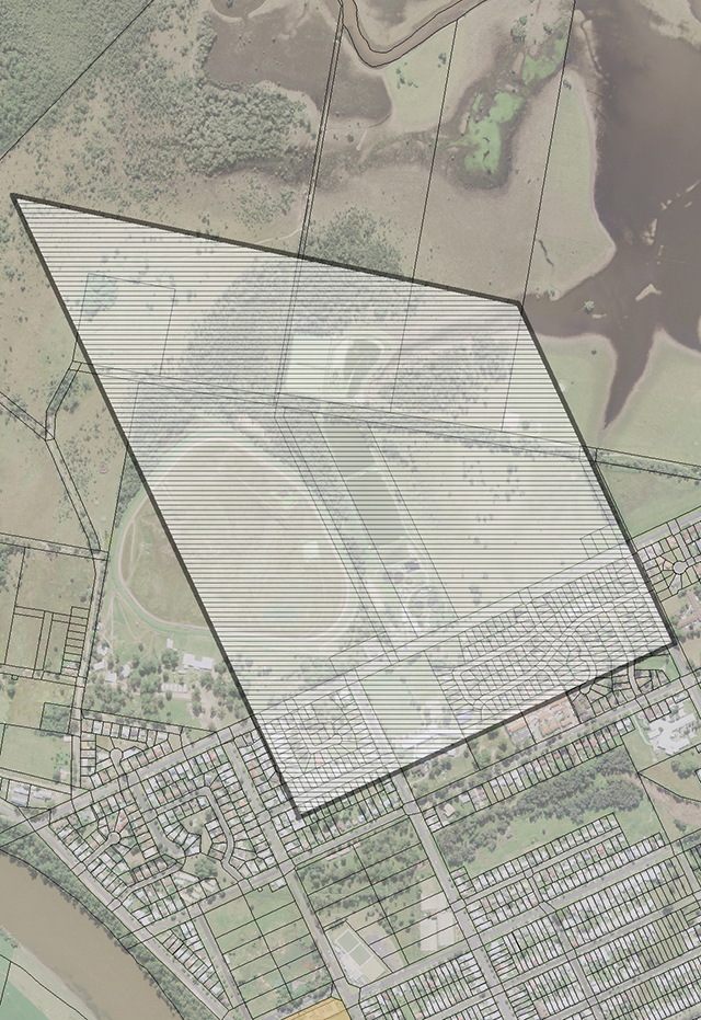
Figure B17-3: Map - North Street Sewerage Treatment Works
Appendix D - Map: Stock Saleyards, Kemp Street
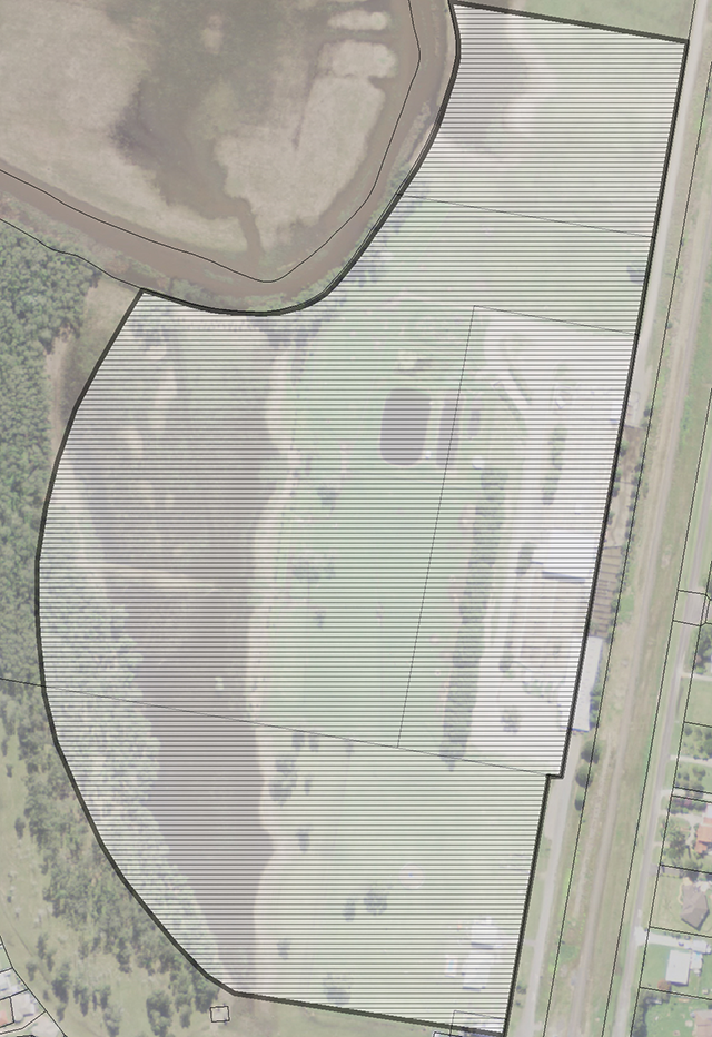
Figure B17-4: Map - Stock Saleyards
Appendix E - Map: Tick Dip Site No.1, Kemp Street
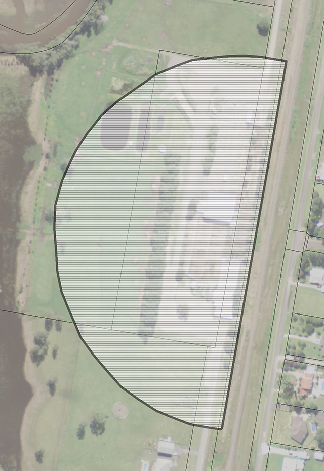
Figure B17-5: Map - Tick Dip Site No.1
Appendix F - Map: Central Garbage Depot, Crescent Head Road
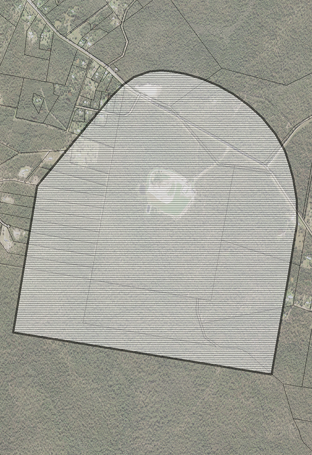
Figure B17-6: Map - Central Garbage Depot
Appendix G - Map: Churchill Quarry, Crescent Head Road
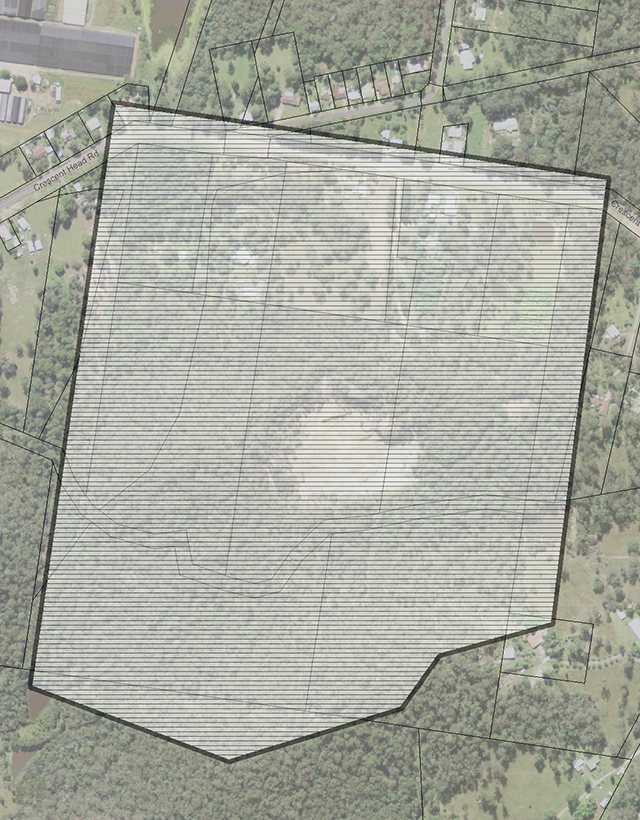
Figure B17-7: Map - Churchill Quarry
Appendix H - Map: Tick Dip Site 2
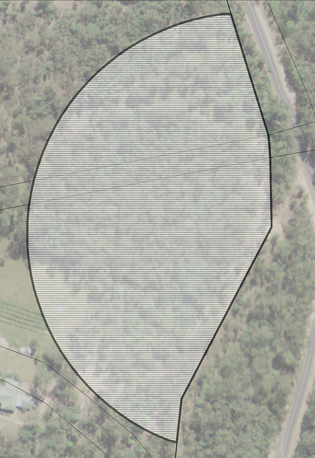
Figure B17-8: Map - Tick Dip Site No.2
Appendix I - Map: Tick Dip Site 3
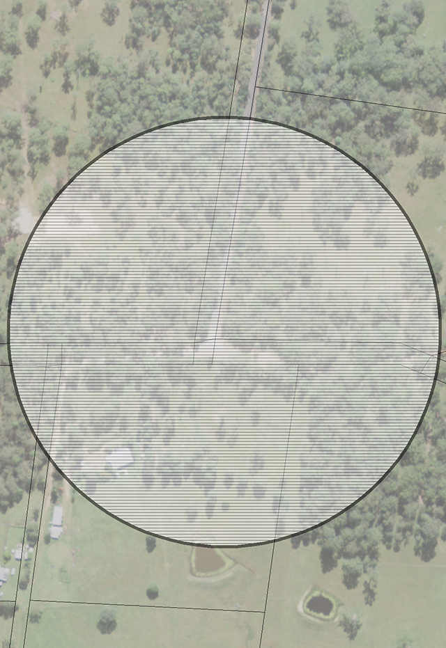
Figure B17-9: Map - Tick Dip Site No.3
Appendix J - Map: Tick Dip Site 4
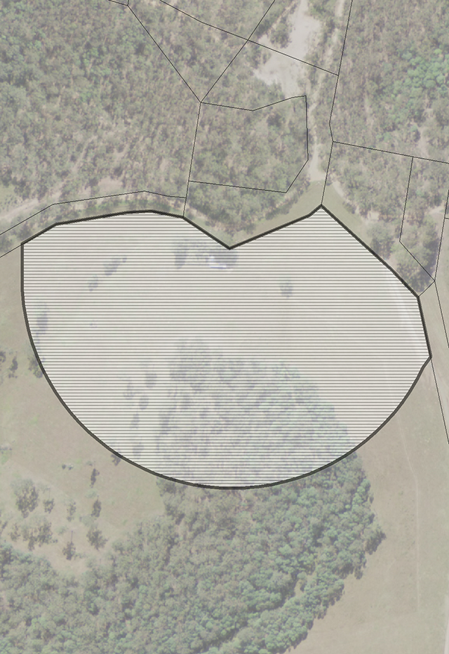
Figure B17-10: Map - Tick Dip Site No.4