Flood information & cameras
Emergency help
For emergency help in a flood or severe storm, phone the SES on 132 500.
Latest Council news
For Council news on emergencies, go to our Council news & updates page.
What to do before, during and after a flood
Visit the SES website for a list of actions to take before, during and after a flood or severe storm.
Rainfall and river conditions
For the latest on local conditions, see the Bureau of Meteorology’s website.
Macleay catchment rainfall and water levels
Use the Macleay MHL Flood and Coastal Intelligence Tool to find information on the status of the Macleay River catchment.
Flood studies
For local flood studies and publications, go to our Rivers page.
To find out which properties in the Kempsey Shire are likely to be affected by flooding, use the Kempsey Flood Planning map.
Through Kempsey Shire Council you can request a flood search containing property-specific flood information for stormwater, riverine and/or storm-tide flood risk types by filling in this Flood Search Application form.
Flood cameras
Kempsey Traffic Bridge flood camera

Manly Hydraulics Lab maintains a flood monitoring camera on the Macleay River at Kempsey as part of the Kempsey flood warning system.
Camera images are updated every hour in normal conditions.
Please note the time stamp on the Kempsey Traffic Bridge camera is stamped with Australian Eastern Standard Time, NOT Australian Eastern Daylight Time.
Sherwood Bridge flood camera
The Sherwood Bridge flood monitoring camera displays the bridge deck so residents can see if the bridge is affected by flooding of the Macleay River.
Please note the time stamp on the Sherwood Bridge camera is stamped with Australian Eastern Standard Time, NOT Australian Eastern Daylight Time.

Camera images are updated about every 30 minutes. View High resolution floodcam image (jpg - 333 KB)
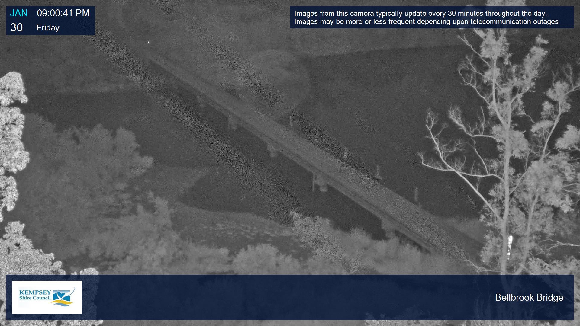
Bellbrook Bridge camera
The Bellbrook Bridge flood monitoring camera displays the bridge deck so residents can see if the bridge is affected by flooding of the Macleay River.
Please note the time stamp on the Bellbrook Bridge camera is stamped with Australian Eastern Standard Time, NOT Australian Eastern Daylight Time.

Camera images are updated about every 30 minutes. View High resolution floodcam image (jpg - 333 KB)
Turners Flat Bridge camera
The Turners Flat Bridge flood monitoring camera displays the bridge deck so residents can see if the bridge is affected by flooding of the Macleay River.
Please note the time stamp on the Turners Flat Bridge camera is stamped with Australian Eastern Standard Time, NOT Australian Eastern Daylight Time.
Camera images are updated about every 30 minutes. View High resolution floodcam image (jpg - 333 KB)
Flood Gauge Boards
Flood Gauge Boards are used to measure river heights during floods. To see Flood Gauge Boards for Bellbrook Bridge and Turners Flat Bridge, please click the relevant link below:
Bellbrook Bridge Flood Gauge Board
Turners Flat Flood Gauge Board
Time and date
Images are time and date stamped so you can tell when they were taken.
In flood events, the last daylight image will stay on the web page until the first image is captured on the following day.
Bridge closures
When water is over the bridge deck, the road is closed and any 'road closed' signs should be obeyed. After the flood, the road will not be reopened until Council staff have inspected the bridge and cleared any debris.
To find out the status of roads, visit Live Traffic NSW.
Disclaimer
The images on this page come from automated systems. There is no validation of this information. It is your responsibility to make your own decision about the currency, accuracy and completeness of the information and images on this web page. Kempsey Shire Council accepts no responsibility for any loss or damage incurred as a result of this information or its use in any way.
River gauges
Council has recently repaired or replaced several gauges on the Macleay River, up-river of Kempsey.
The most recent gauge readings for the Macleay catchment's up-river area are available on the Bureau of Meteorology's website for Georges Creek, Bellbrook, Toorooka, Moparrabah, Turners Flat, Aldavilla and Sherwood Bridge.
River gauges can be damaged in periods of high flow, requiring repair and potentially giving inaccurate readings. Where possible, gauges are temporarily removed from publication when they are damaged.
Clybucca monitoring
The Clybucca monitoring network set up by the University of New South Wales Water Research Laboratory provides useful information for Clybucca floodplain, Rainbow Reach and Stuarts Point area residents. (Please note the page does not work in all browsers).
Clybucca monitoring station data
Flood warnings and terminology
It can be helpful to learn the language of flood warnings. The Bureau of Meteorology’s website explains common flood terminology in detail.
- A Flood Watch is issued when flood-producing rain is expected to fall in the near future.
- A Flood Warning is issued when flooding is occurring or is expected to occur in a particular location or area.
- A Severe Weather Warning is issued when sudden or flash flooding is expected.
Flood infrastructure
Council manages a range of flood infrastructure which is opened or closed before and during flood events according to Council's Flood Risk Management Plan.
Kinchela Creek and Belmore River both have two sets of flood control structures: flood gates and flood relief gates.
Flood gates
Also known as the main gates or crossover gates, flood gates are closed before a flood.
These gates are normally open to allow natural tide movement along the main channel of Belmore River and Kinchela Creek and the aeration of waterways for aquatic life.
The flood gates are used to prevent flood water progressing upstream but usually allow water to flow downstream into the main river.
If flooding is predicted, Council closes the flood gates to try to prevent water entering the floodplain and save valuable storage.
The gates close firm when water levels downstream are high, such as in a flood or at high tide, and remain closed until water levels return to normal.
Flood relief gates
The flood relief gates are normally open but are closed when a flood is expected.
These gates are used to determine the specific place where floodwater passes through the levees (at the relief gate locations) rather than it spilling over the levee in all locations, like an overfull basin.
The flood relief gates areopened when we exceed a minor flood. If the river level reaches the top of the levee (the roads), the relief gates are opened. This means that the floodplains receive the floodwater in a greater than minor flood event, which is why the relief gates are then closed again as soon as possible afterwards.
It should be noted that this infrastructure is used for mitigation, not prevention. Once the levees will be breached at Kinchela and Belmore, their capacity has been reached and the relief gates must be opened.

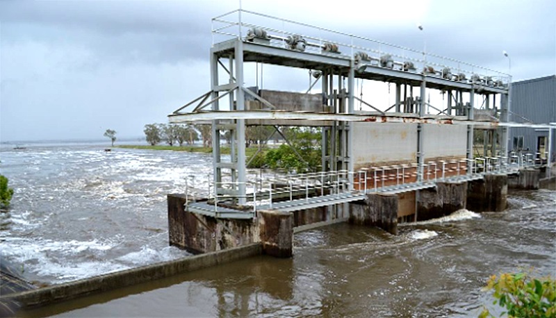
The above picture shows opened flood relief gates, the sluice-style gates that are opened to allow water to flow into the floodplain.

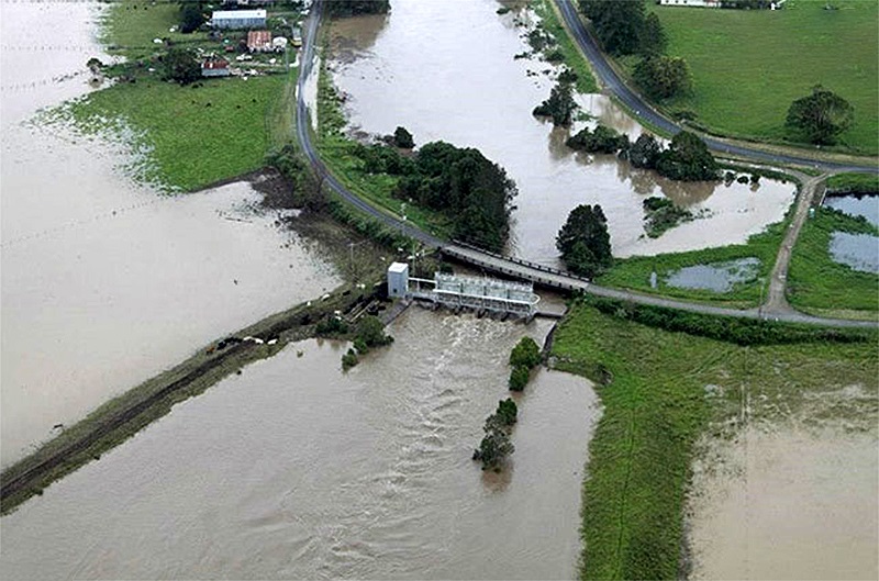
In the above image, you can see the relief gates in the centre of the image discharging water at Belmore River. You can also see the crossover gates on the right that are closed.
Background of Macleay River floodplain risk management
The configuration of the Macleay catchment is practically suited to the production of high peak flood flows. Following major rain storms the Macleay River at Kempsey may rise from a normal dry weather discharge of about 56m³/sec to 14,160m³/sec (the estimated discharge of the August 1949 flood) within a 30-hour period.
Several significant floods may occur in a short period of time, as was the case in the periods between 1863-75 and 1890-93, and 2009-2013. In 1949 and 1950 Kempsey experienced the two worst floods ever recorded, within eight months of each other.
For more information click this link.