Macleay Valley Final Flood Update
Published on 11 March 2025

KEMPSEY SHIRE FLOOD FINAL UPDATE
Update as of 5.30pm Tuesday 11 March 2025.
KEY CHANGES
The Bureau of Meteorology has issued a Final Flood Warning for the Macleay River. No further flooding is expected.
The Macleay River has now fallen below the minor flood level.
This means there will be no further formal flood updates from Council. Road and bridge specific updates will be provided as these reopen.
Further roads and structures may have sustained damage. If a road or bridge is closed, please do not proceed until Council has had time to inspect and reopen the route if it is safe to do so.
Please monitor livetraffic.com.au, Kempsey Shire Council’s Website and Facebook page for road updates.
Please do not enter flood waters and follow advice from the emergency services. Avoid structures that are flooded as structural damage can occur.
Current NSW SES warnings and advice are available at https://www.ses.nsw.gov.au/northern-nsw
FLOOD WARNING
The Bureau of Meteorology has issued a Final Flood Warning #15 for the Macleay River at 9.54am, on Tuesday 11 March 2025.
For the full warning, head to http://www.bom.gov.au/nsw/warnings/flood/macleayriver.shtml
COUNCIL SERVICES
Waste collections to South West Rocks, Arakoon and Crescent Head are affected by floodwaters and road closures. Please leave bins out for collection as Cleanaway will resume services as soon as it is safe to do so. Thank you for your understanding.
To check status of Kempsey pool, please refer here https://www.facebook.com/profile.php?id=100093030480175
Check South West Rocks and Gladstone pools' status at https://www.facebook.com/hudoswim
Sports fields are CLOSED.
STUARTS POINT
There are no longer concerns surrounding groundwater levels at Stuarts Point due to this event.
RIVER LEVELS AND TRENDS
Please refer below for current river level trends:
- Georges Creek – 5.27m at 11:30am Tue – Falling to 4.82m at 4:30pm Tue
- Bellbrook – 5.45m at 11:41am Tue – Falling to 5.36m at 2:26pm Tue
- Turners Flat – 5.80m at 11:00am Tue – Falling to 5.57m at 4:00pm Tue
- Aldavilla D/S – 5.27m at 11:19am Tue – Falling to 4.96m at 4:39pm Tue
- Kempsey Traffic Bridge – 4.60m at 11:41am Tue Falling to 4.34m at 4:20pm Tue
- Smithtown – 3.26m at 11:30am Tue – Falling to 3.02m at 4:30pm Tue
For the latest river level trends, please refer here: http://www.bom.gov.au/cgi-bin/wrap_fwo.pl?IDN60141.html
DRIVING CONDITIONS
Please do not take unnecessary risks and do not drive through flood waters. IF IT’S FLOODED, FORGET IT.
If you are in a known flood-prone area, we encourage you to take note of the current conditions and assess if you should implement your flood plan.
Flood damage to road, bridge and drainage infrastructure could be present in several locations, if you are travelling exercise great caution.
RIVER CROSSINGS
- Bellbrook Bridge is CLOSED
- Toorooka Bridge is CLOSED
- Temagog Bridge is CLOSED
- Turners Flat Bridge is CLOSED
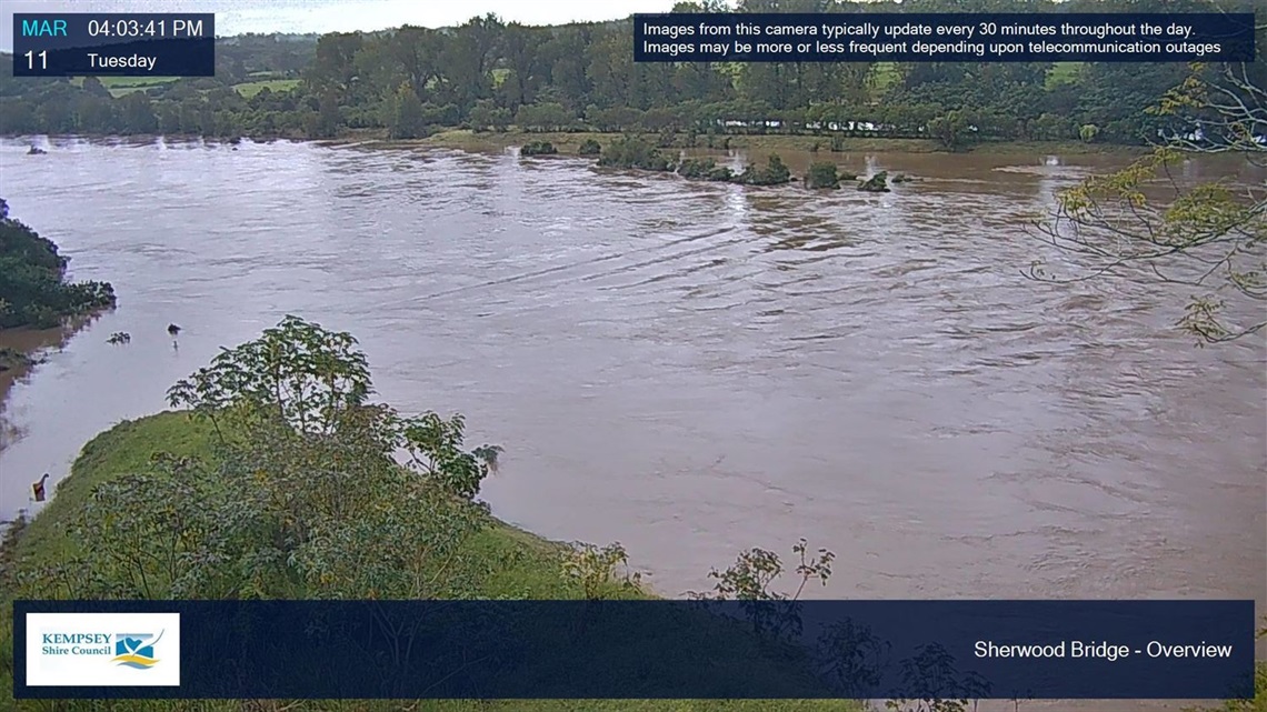
- Sherwood Bridge is CLOSED
- McCoy’s Bridge on Willi Willi Road is CLOSED
- Nurse Kirkpatrick Bridge on Nulla Nulla Creek Road is CLOSED
- Dungay Creek Causeway is CLOSED
- Dowlings Falls Causeway is CLOSED
ROAD CLOSURES
At present the following roads have been marked as CLOSED:
- Old Aerodrome Road is CLOSED
- Saleyards Road is CLOSED
- Verge Street (Kempsey Central and Riverside Carpark and surrounds) is CLOSED
- Kinchela Left and Right Bank Roads are CLOSED
- Belmore River Left Bank Road is CLOSED
- Summer Island Road is CLOSED
- Gladstone Street Underpass is CLOSED
- First Lane is CLOSED
- Euroka Road from Theresa Street to Mary’s Bay Road is CLOSED
- Willi Willi Road at McCoy’s Bridge is CLOSED due to structural damage
- Nulla Nulla Creek Road at Nurse Kirkpatric Bridge is CLOSED due to abutment damage
Some roads may become impassable without Council knowledge or our resources are too stretched, exercise caution and never enter floodwaters.
FLOODGATES
The floodgates on Kinchela Creek, Belmore River, Christmas Creek and Euroka Creek are CLOSED.
Flood relief gates at Kinchela Creek and Belmore River are CLOSED.
More information available at https://ksc.pub/gates
OCEAN OUTLETS
Ryans Cut Outlet is OPEN to the ocean.
Big Hill Outlet is CLOSED to the ocean.
Council staff continue to monitor the Big Hill ocean outlet. There is currently not enough water pressure upstream to trigger its opening.
REPORT ISSUES
Call 6566 3200 or head to https://www.kempsey.nsw.gov.au/Your-Valley/Have-your-say/How-can-we-help
STAY INFORMED
NEXT FORMAL UPDATE
This will be the final formal update.