Stuarts Point Drainage Study
- Completion Date19 December 2023
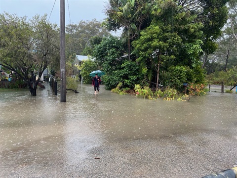
Council conducted a review of Stuarts Point’s drainage system through a Groundwater Study and Stormwater Study to reduce the risk of flooding in the area.
Location
The drainage studies covered the Stuarts Point, Grassy Head and Fisherman’s Reach areas.
There was a focus on the Stuarts Point area.
Status
Council engaged external consultant GHD to carry out the studies.
The studies have found a solution supported by modelling that reduces flooding in Stuarts Point.
Groundwater study
Council installed groundwater monitoring bores in several locations in Stuarts Point during April and May 2023.
These groundwater bores provide valuable data to Council, helping to gain a better understanding of the complex groundwater situation in Stuarts Point.
The locations for the groundwater bores were carefully selected to provide cross-sectional data over Stuarts Point, which will be used for modelling purposes. This data will be crucial in developing long-term solutions to address issues related to groundwater in the area.
Stormwater study
An Options Analysis was conducted to assess possible solutions to stormwater drainage challenges.
This included analysing how effective stormwater drains, pumped dewatering and stormwater pipes could be.
Open drains, stormwater pit/stormwater pipes were identified as the preferred solution.
Open drains to the east were not feasible due to the required depth of around 2 – 4 metres.
Modelling of the stormwater pit and pipe networks indicated a reduction in flood depths approximately 500mm.
Funding
Council applied and received $300,000 from the NSW Government’s Disaster Risk Reduction Fund.
Location
Ocean Avenue, Stuarts Point 2440 View Map
-30.8203548,152.9901097
Ocean Avenue ,
Stuarts Point 2440
Ocean Avenue ,
Stuarts Point 2440
Stuarts Point Drainage Study