Flood mitigation infrastructure
Council manages a range of flood infrastructure which is opened or closed before and during flood events according to Council's Flood Risk Management Plan.
Kinchela Creek and Belmore River both have two sets of flood control structures: flood gates and flood relief gates.
Flood gates
Also known as the main gates or crossover gates, flood gates are closed before a flood.
These gates are normally open to allow natural tide movement along the main channel of Belmore River and Kinchela Creek and the aeration of waterways for aquatic life.
The flood gates are used to prevent flood water progressing upstream but usually allow water to flow downstream into the main river.
If flooding is predicted, Council closes the flood gates to try to prevent water entering the floodplain and save valuable storage.
The gates close firm when water levels downstream are high, such as in a flood or at high tide, and remain closed until water levels return to normal.
Flood relief gates
The flood relief gates are normally open but are closed when a flood is expected.
These gates are used to determine the specific place where floodwater passes through the levees (at the relief gate locations) rather than it spilling over the levee in all locations, like an overfull basin.
The flood relief gates areopened when we exceed a minor flood. If the river level reaches the top of the levee (the roads), the relief gates are opened. This means that the floodplains receive the floodwater in a greater than minor flood event, which is why the relief gates are then closed again as soon as possible afterwards.
It should be noted that this infrastructure is used for mitigation, not prevention. Once the levees will be breached at Kinchela and Belmore, their capacity has been reached and the relief gates must be opened.
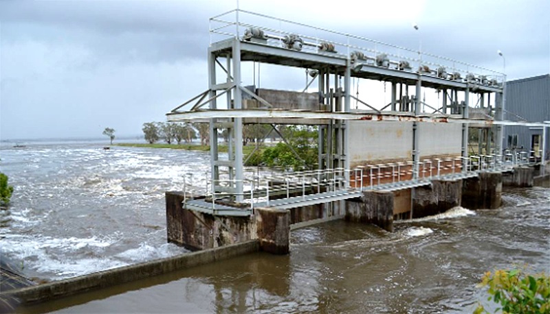
The above picture shows opened flood relief gates, the sluice-style gates that are opened to allow water to flow into the floodplain.
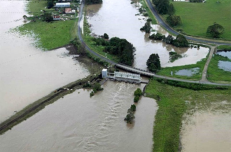
In the above image, you can see the relief gates in the centre of the image discharging water at Belmore River. You can also see the crossover gates on the right that are closed.